Sulukta (Suluktu)
Sülüktü, also spelled Sulukta or Suliukta (Сүлүктү; Sulukta / Сулукта; Сулюкта) is a town located at the extreme western end of Batken Region in southern Kyrgyzstan. Sülüktü is situated at the southern fringe of the Fergana Valley in a region surrounded on three sides by Tajikistan.
The word "sülüktü" is believed to have come from the Turkic word "suluk" or "zuluk" which means a "leech". According to this view, the waters of present-day Sülüktü had leeches and therefore people called the place "suluktu" which literally means "containing leeches." Sülüktü is one of Central Asia's oldest coal extraction sites. The first industrial coal mine of Sülüktü was opened in 1868. Sülüktü was made into a town in 1940. Sülüktü is the first town in Kyrgyzstan where Soviet rule was established.
Sülüktü is directly subordinated to Batken Region. In other words, it is not part of any district. The urban-type settlement of Vostochny and the village of Koltso are also governed by the Sülüktü Town Council. In 2021 the population of Sülüktü itself was 14,770 and the combined population of Sülüktü and the subordinated villages was 24,238. Its area is 18 km2.
There were several large coal mines and factories in Sülüktü during Soviet times. Following the collapse of the USSR, the majority of these factories were abandoned. A lack of professionals and machinery, mismanagement, and falling income levels — all contributed to this downfall. While Sülüktü was once an important industrial center, nowadays it gives the impression of an abandoned town.
Sülüktü is one of Central Asia's oldest coal extraction sites. The first industrial coal mine of Sülüktü was opened in 1868. Sülüktü was made into a town in 1940. Sülüktü is the first town in Kyrgyzstan where Soviet rule was established.
Sülüktü was an important industrial town in the Soviet Union. The town had several large coal mines. In addition to coal, deposits of gypsum, quartz sand, and limestone were also extracted. Sülüktü was also home to a meat processing and packaging factory, a creamery, a brick factory, and several clothing factories. After the dissolution of the USSR, the majority of ethnic Russians and Tatars living in Sülüktü left the town. There were many experienced workers among those who left. In the 1990s, almost all of the factories in Sülüktü were closed down as a result of a lack professionals, disruption of Soviet trade routes, ageing machinery, and mismanagement.
Map - Sulukta (Suluktu)
Map
Country - Kyrgyzstan
 |
 |
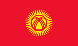
| Flag of Kyrgyzstan | |
Ethnic Kyrgyz make up the majority of the country's 6.6 million people, followed by significant minorities of Uzbeks and Russians. The Kyrgyz language is closely related to other Turkic languages.
Currency / Language
| ISO | Currency | Symbol | Significant figures |
|---|---|---|---|
| KGS | Kyrgyzstani som | Ñ | 2 |
| ISO | Language |
|---|---|
| KY | Kirghiz language |
| RU | Russian language |
| UZ | Uzbek language |


